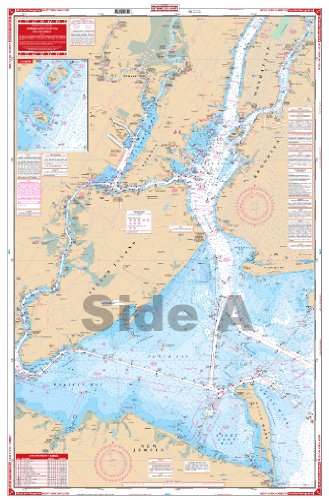
Waterproof Chart, 62 NEW YORK HARBOR
- List Price:
$34.99 - Sale Price: $26.95
- Amount Saved: $8.04
- Availability: Usually ships in 1-2 business days
Feature
- Two Sided
- Foldable
- Tear Resistant Synthetic Paper (Hop-Syn) 5 PP Tree Friendly
Product Description
The best chart for the New York City area combining information from five government charts! Covers Sandy Hook Bay, the entire Lower Bay and Raritan Bay, Staten Island, Brooklyn, Jersey City, Newark, and lower Manhattan on one side. The reverse side covers the East River through Hell Gate and out past Rikers Island, under the Throgs Neck Bridge to Kings Point, as well as the Harlem River north to the Hudson. Colored key and panel designations and large print place names make this chart easy to use. Information from 5 NOAA Charts: #12342, #12366, #12327, #12334 and #12339. Chart is 25" X 38". WGS84 - World Mercator Datum.
Product Detail
- ASIN: B0014471EE
- Item model number:
- Average Customer Review: Customer Reviews
Customers Who Viewed This Item Also Viewed


About Us

Free Shipping
If your order is $35 or more, you may qualify for free shipping. With free shipping, your order will be delivered 5-8 business days.

